Updated On: 7/2/2026 -
Valid Until: 07/03/2026 - 9:00 AM
Forecaster(s): A. Jamison
Pocket Fire
Special Statement:
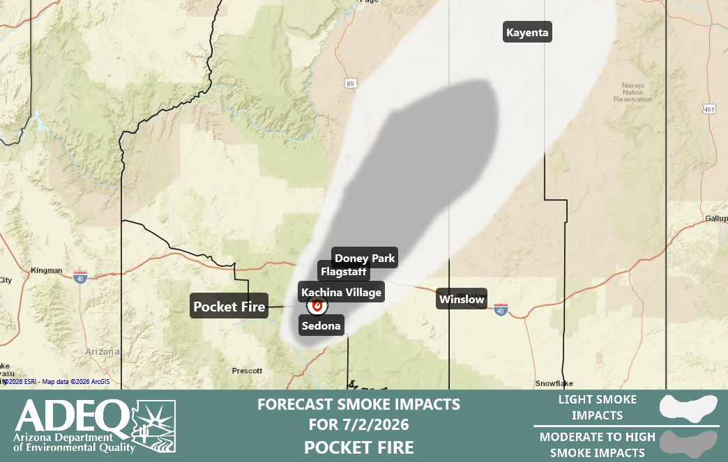
Smoke Map For 7/2/2026
Overview
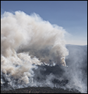
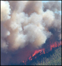
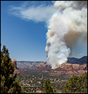
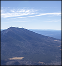
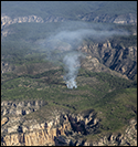
The Pocket Fire, located 7-10 miles north of Sedona, is now estimated at 20,680 acres, increasing by about 2800 acres from yesterday morning. It has 22% containment. Yesterday, the fire continued to be very active, sending a thick plume of smoke to the north and then shifting more to the northeast eventually stretching to the Four Corners area and beyond. This morning, some smoke continues to move off to the north. Thick smoke also drained into Sedona overnight. Today, conditions will be similar to yesterday which will be favorable for more fire growth.
Smoke Synopsis
This morning, moderate to heavy smoke is not only affecting areas north and northeast of the fire but also Sedona once again with the thickest observed conditions. Smoke extends further south and southwest towards the Verde Valley as well. Smoke should improve significantly by 10 am.
Today, smoke conditions will improve in most areas as the morning progresses (except for a relatively narrow corridor extending north-northeast) before smoke production increases in the afternoon and tracks northeastward similar to the past few days. Smoke will also likely reach the the Four Corners area and beyond given the strength of the transport winds. Moderate to heavy smoke impacts are expected to continue for areas just downwind of the fire, including Kachina Village. Flagstaff and Doney Park. Areas further downwind, namely on the reservations, could experience light to moderate impacts as smoke mixes to the ground. That includes locations such as Cameron, Chinle, Rough Rock, and Kayenta.
Tonight, if the fire remains active, much of the smoke will continue to move to the north-northeast and affect locales in and around Flagstaff for at least part of the night. But, it is expected that there will also be smoke that drains into Sedona in the overnight hours for at least moderate, if not heavy, impacts.
Friday, smoke is expected to initially disperse to the north and northeast again, similar today and previous days. How much smoke occurs and how far it reaches downwind will depend on fire activity.
Saturday, a downtrend in smoke production is anticipated due to a significant increase in humidity and cloudiness. But, there are a lot of uncertainties that remain.
Note: the next forecast will be issued on Saturday, 7/4.
Forecast
Click the name of the city to view smoke forecast
Smoke Forecast:
Thursday
Thursday Night
Friday
Moderate impacts in the morning; moderate to heavy impacts possible in the afternoon.
Moderate to heavy smoke impacts possible overnight
Moderate smoke impacts possible in the morning; moderate to heavy impacts possible during the afternoon.
Activity Meter
Legend:
1
- Stay Smoke Aware
2
- Minimize Outdoor Activity
3
- Stay Inside
Note: No matter what the forecast indicates, if you feel like you are having health effects from smoke exposure, take extra care to stay inside or safely get to an area with better air quality. Please contact your healthcare provider with specific concerns.
Smoke Forecast:
Thursday
Thursday Night
Friday
Moderate to heavy smoke in the morning before improving then moderate to heavy smoke possible in the late afternoon.
Moderate to heavy smoke possible in the early evening before improving followed by potential for heavy smoke overnight.
Moderate to heavy smoke in the morning before improving followed by moderate to heavy smoke possible in the evening/
Activity Meter
Legend:
1
- Stay Smoke Aware
2
- Minimize Outdoor Activity
3
- Stay Inside
Note: No matter what the forecast indicates, if you feel like you are having health effects from smoke exposure, take extra care to stay inside or safely get to an area with better air quality. Please contact your healthcare provider with specific concerns.
Smoke Forecast:
Thursday
Thursday Night
Friday
Heavy smoke this morning with clearing by about 10am; smoke plume visible to the north during day
Heavy smoke is expected to return as early as late evening and especially after midnight.
Heavy smoke during the first part of the morning followed by improvement during the latter part of the morning.
Activity Meter
Legend:
1
- Stay Smoke Aware
2
- Minimize Outdoor Activity
3
- Stay Inside
Note: No matter what the forecast indicates, if you feel like you are having health effects from smoke exposure, take extra care to stay inside or safely get to an area with better air quality. Please contact your healthcare provider with specific concerns.
Smoke Forecast:
Thursday
Thursday Night
Friday
Smoke visible to the west and north.
Haze possible
Smoke visible to the west and north.
Activity Meter
Legend:
1
- Stay Smoke Aware
2
- Minimize Outdoor Activity
3
- Stay Inside
Note: No matter what the forecast indicates, if you feel like you are having health effects from smoke exposure, take extra care to stay inside or safely get to an area with better air quality. Please contact your healthcare provider with specific concerns.
Smoke Forecast:
Thursday
Thursday Night
Friday
Smoke mostly overhead, with light impacts possible
Smoke mostly overhead, with light impacts possible
Smoke mostly overhead, with light impacts possible
Activity Meter
Legend:
1
- Stay Smoke Aware
2
- Minimize Outdoor Activity
3
- Stay Inside
Note: No matter what the forecast indicates, if you feel like you are having health effects from smoke exposure, take extra care to stay inside or safely get to an area with better air quality. Please contact your healthcare provider with specific concerns.
Useful Links
Inciweb |
View Page >
ADEQ Smoke Monitors |
View Page >
EPA Fire and Smoke Map |
View Page >
Federal Incident Management Team Smoke Forecast |
View Page >
Fire Information Contact
Phone: 928-260-0543
Email:
[email protected]
Create PDF Version of Smoke Forecast
Select the locations to display in the PDF. Note: Works best to select less than five locations.
Notice: This forecast is based on fine particulates only; ozone is not included. Forecasts may be wrong; use at own risk. Use caution as conditions can
change quickly. See your health professional as needed. Smoke sensitive groups should take appropriate precautions.